Excavations at EU-5 were completed early this week. Once archaeologists exposed the natural hardpan at the base of the unit, excavations were terminated. While the hardpan undulated throughout the unit, as was also observed in the previous units, the maximum depth of EU-5 was approximately 150 cm (5 ft) below datum, or 130 cm (4.2 ft) below surface (Figure 1). Few artifacts were recovered from the lower levels of EU-5, again similar to the other units from the project area.
Mission Gate and Lunette Archaeology - January 20
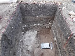
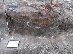
Once excavations ceased at EU-5, documentation of the unit commenced. Documentation included numerous photographs from various directions and mapping of the unit. The different soils within the profile, or excavation wall, are identified and then mapped, or drawn, using exact measurements. The soil layers are then meticulously described, noting the texture, color (using a Munsell soil book), composition, and any inclusions. In EU-5 the stratigraphy resembled what was observed in EU-4 (Figure 2).
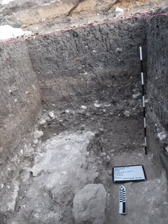
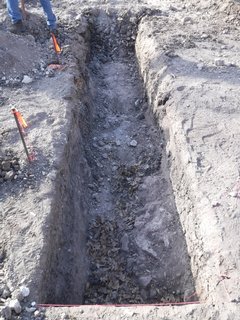
None of the excavation units found any evidence of the south wall of the mission complex as seen and described in archival maps and reports. Additionally, very few artifacts were recovered, no where near the quantity and density one would expect at this location. With this information it was decided to dig a northwest-southeast trench the entire width of the expected location of the south wall and low barrack structure (Figure 3). This trench was slowly excavated via backhoe in approximately 30 cm (12 in) sections. Archaeologists closely monitor the work and screen every third scoop of soils. No evidence of a wall or any structure was encountered and very few artifacts were observed. After excavation of the trench, archaeologists document the soil profiles using the same methodology used for unit documentation (Figure 4).
