Alamo Plan Phase 2 Archaeology - August 11

August 11, 2023

Archaeological investigations continued in the Phase 2 Project Area this week. Excavation of five backhoe trenches (#s 9, 10, 5, 6, 4, and 1) was completed. All trenches showed evidence of previous disturbance and no archaeological features, such as structural elements, were encountered.

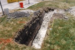
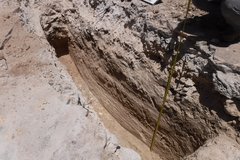
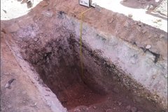
At the southern end of Plaza de Valero, two trenches (BHTs 9 and 10) were placed in the grassy lawn area. These trenches were oriented east to west and were approximately 13 ft x 3 ft. Excavations terminated at a maximum depth of approximately 4 ft, when a deposit of degraded limestone was encountered across the extent of the trenches (Figures 1 and 2). Artifacts observed in this trench include metal nail fragments, container glass shards, and one white earthenware ceramic sherd.

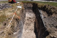
Dug out trench facing east
Figure 1. Trench 9 overview, facing east.
Dug out trench facing west in a grassy area
Figure 2. Trench 10 overview, facing west. Note the degraded limestone at the base of the trench.

Another trench (BHT 6) was excavated within the sidewalk on the eastern side of Alamo Plaza. This trench was approximately 13.5 ft x 3 ft and extended 6 ft below surface. Within this trench the soils were mixed as a result of previous construction work in the area. At the base of the trench, archaeologists encountered Navarro clay, a natural soil deposited before cultural occupation (Figure 3). There were no artifacts within this trench.

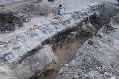
Trench 5, located in the sidewalk northeast of the Mission Gate exhibit, was approximately 25 ft in length, 3 ft in width, and extended to a depth of 4 ft below surface. As seen in the previous trench, the soils were mixed indicating previous disturbance in the area. Within the mixed context soils, some artifacts were observed including metal fragments, ceramic sherds (transfer ware and European ware), and glass shards. The natural hardpan, a compacted degraded limestone, was encountered at approximately 3 ft below surface. The hardpan is an undulating geological deposit that has been encountered at shallow depths across the Alamo site. In some areas the hardpan is soft enough for a backhoe to scrape and remove in angular pieces. However, in other areas the hardpan is cementitious and cannot be easily removed. Excavation exposed a continuous layer of hardpan across the entire length of the trench (Figure 4). There were no indications (e.g., limestone blocks, foundations/footings, adobe) of any type of structural remains present in the trench.

Dug out trench facing northeast in a dirt area
Figure 3. Trench 6 overview, facing northeast. Note the Navarro clay at the base of trench.
Dug out trench facing northeast in excavation area
Figure 4. Trench 5 overview, facing northeast.

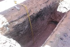
One trench (BHT 4) was excavated south of the Lunette. This trench was approximately 15.5 ft in length and 3 ft in width. During excavation, an active electrical conduit was encountered resulting in the termination of the western half of the trench at approximately 2 ft below surface. The eastern half extended to a depth of approximately 7 ft before it encountered the hardpan surface (Figure 5). Very few artifacts (1 nail, colorless glass shards, and white earthenware) were encountered in this trench.

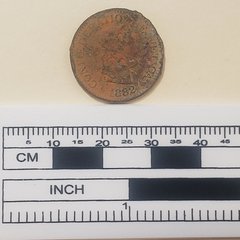
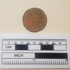
The last completed excavation (BHT 1) for the week was a north-south oriented trench within Alamo Street, northwest of the Mission Gate exhibit. This trench was approximately 13 ft in length, 3 ft in width, and extended 4 ft below surface (Figure 6). During excavation construction gravels and a utility vault were encountered in the northern half of this trench. In the southern portion of the trench, there was a thin layer of soil below the road base. This soil was a silty clay and contained an abundance of inclusions (such as gravels and calcium carbonate flecks), suggesting the soil was deposited as a “fill” soil. A “fill” soil refers to soil that has been previously excavated and often combined with another soil and/or gravels to create a mix that is used in landscaping and construction. Below the soil was a natural caliche marl. There were no indications of previous structures in the trench. Some artifacts were recovered from this trench including cut faunal bone and three Valero ware ceramic sherd. Also, within the fill soil, at approximately 20 inches below surface, archaeologists recovered a coin stamped with 1882. Upon further investigation, the coin is an 1882 10 Rappen from Switzerland (Figure 7)!

Dug out trench facing southwest in excavation area
Figure 5. Completed Trench 4, facing southwest.
Coin that says Confederation Helvetica 1882 next to a ruler
Figure 7. Front of 1882 10 Rappen coin from Switzerland.
Dug out trench facing east in an excavation area
Figure 6. Maximum depth of Backhoe Trench 1, facing east.
Coin with number 10 in the center with perimeter of leaves next to a ruler
Figure 7. Back of 1882 10 Rappen coin from Switzerland.

Previous construction work in Alamo Plaza, over the last hundred years, has greatly affected the landscape and the below grade conditions. This is likely the reason there are so few archaeological deposits. Excavations will continue next week.